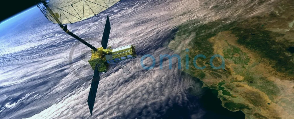
In a significant advancement for Earth observation, the NISAR satellite is set to launch from the Satish Dhawan Space Centre near Chennai in just a few days. This revolutionary satellite is equipped with the capability to detect changes on Earth’s surface with remarkable precision, measuring down to the centimetre in nearly real-time, irrespective of weather conditions or time of day. Weighing approximately 3 tonnes and featuring an impressive 12-metre radar antenna, the NISAR satellite represents a staggering investment of US$1.5 billion.
Developed as a collaboration between the United States’ NASA and India’s ISRO, NISAR is designed to track the Earth’s surface—including both land and water—offering vital data that will benefit farmers, climate scientists, and emergency response teams alike. Traditional Earth observation satellites, which rely on sunlight to capture images, are limited to clear daylight conditions. This sets the stage for challenges particularly in tropical or frequently cloudy regions, where obtaining consistent imaging can be problematic.
NISAR employs synthetic aperture radar (SAR) technology, enabling it to overcome these limitations. Unlike passive imaging satellites, which depend on natural light, SAR actively emits radar signals to capture images of the Earth. This method allows the satellite to function effectively both day and night and under adverse weather conditions like cloud cover, smoke, or ash—making it particularly valuable during natural disasters such as floods or wildfires.
Radar technology also allows NISAR to penetrate dense vegetation, providing crucial data that can reveal hidden environmental patterns. With its dual-frequency approach, the satellite is equipped to deliver higher resolution imaging than its European counterpart, the Sentinel-1 satellites, which use a single radar frequency. NISAR’s advanced capabilities will significantly enhance monitoring efforts in regions like Antarctica and allow for detailed vegetation and water assessments.
The satellite’s features extend to monitoring forest biomass and tracking the dynamics of Earth’s ice sheets, glaciers, and coastal erosions, which are essential for understanding climate change and environmental health. Additionally, NISAR has the capability to detect minute changes in the Earth’s surface height, revealing subsidence patterns related to human activities, and mapping the aftermath of earthquakes and landslides—an important function for disaster recovery operations.
Agricultural applications are another focus area for NISAR, as it can provide high-resolution data on soil moisture levels, helping farmers make informed decisions about irrigation. This can lead to improved crop yields and more efficient water use. The satellite’s mission data will be made available freely to the public, promising to democratize access to critical environmental information.
Due for launch on June 18, the NISAR satellite marks a decade of development and is one of the most expensive Earth-imaging projects ever. The anticipated comprehensive data set offers the potential for transformative impacts on science and societal resilience in the face of natural challenges.


